On the Day
This site visit is informed by Aboriginal pedagogies encouraging connection, non-verbal communication and collaboration. Therefore, physical resources on the day of the visit are deliberately minimal. Resources required are:
- Clipboard (one per group)
- Pencils
- Design a Fishway Worksheet (Activity 2)
- Objects found in the area, such as rocks, fallen leaves and sticks (Activity 2)
- Teacher iPad to document learning experiences
Before the Visit
Students will have been exploring and researching the history and geography of the Birrarung/Yarra River, with a focus on the migration of fish and eel species and how our local river system connect to other waterways across Victoria. The following digital resources support this learning in the classroom and prepare students for the site visit:
Website: Wurundjeri Woi-Wurrung Cultural Heritage Aboriginal Corporation. Students can use this website to research local history including the stories of Wurundjeri ancestors. The website provides images and drone footage of significant places that support students to understand the larger geographic context of Dights Falls.
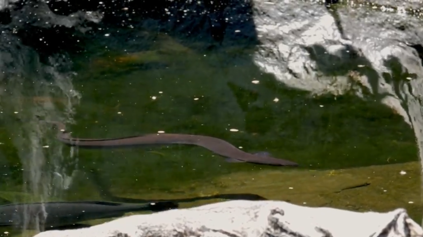
Video: The journey of the eels of the Yarra River. In this video, Aunty Faye Stewart-Muir of Boon Wurrung country shares a story written by Aunty Carolyn Briggs about the migration of eels in the Yarra. Students will have plotted the migration of the eels on their Birrarung Map and have been researching the connection to their local area around Dights Falls.
Digital Map: Mapping Aboriginal Melbourne. This map and timeline helps students to understand the historical and contemporary importance of the Birrarung and connect this with their knowledge of eel and fish migration.
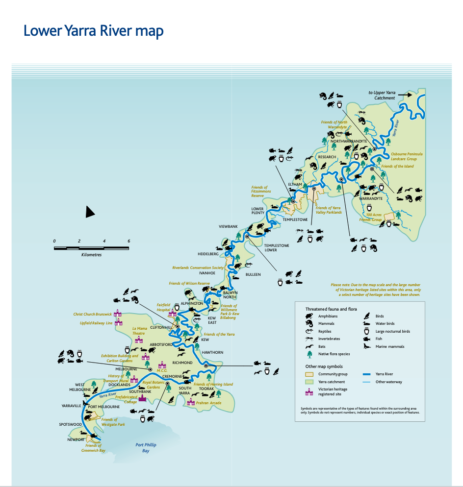
Map of the Birrarung (Yarra): Using this map from Melbourne Water as inspiration, students will collaborate in class to design their own map of the Yarra, focusing in on the local area of Yarra Bend and Dights Falls.
After the Visit
After the visit, students will consolidate their knowledge by working in teams to create a working model of a fishway. They may choose to create an accurate model of the current design, a historical interpretation (prior to colonial intervention) or to create their own design with inspiration from their knowledge of Indigenous fishing/trapping techniques. The models may be built with any sustainable materials (though not strictly sustainable, re-usable items such as Lego are permitted) or using digital resources such as 3D modelling, AI video creation and so on.
This video by Melbourne Water is a timelapse of the construction of the fishway. Students may wish to watch this as part of their independent research after the site visit. Some inquiry questions include: What steps were included in the construction of the fishway? What materials have they used – manmade, natural or both? Why are there some large time gaps when no work was being done? Could there be specific reasons for that related to the geography and environment?
Teacher Resources for Researching and Planning
WWCHAC information brochure describes their educational walking tours on which this site visit is based. The Learning Outcomes and Success Criteria in the document below have informed the design of the visit, ensuring that our time on the site also meets the objectives of this important community organisation.
This academic paper contains a useful chronology of activity at Dights Falls and a list of the fish species that are in the Yarra and potentially impacted by the fishway. Teachers may wish to summarise this for learners or invite individual students to summarise it as an extension/challenge task.